
Dartmouth’s DOC First-Year Trips Program has been a cornerstone of Dartmouth’s culture since the early 20th Century. From learning the Salty Dog Rag to visiting Moosilauke, Trips are the first real taste of Dartmouth that incoming freshmen receive. Accordingly, the Dartmouth community is often opposed to any alteration to Trips culture.
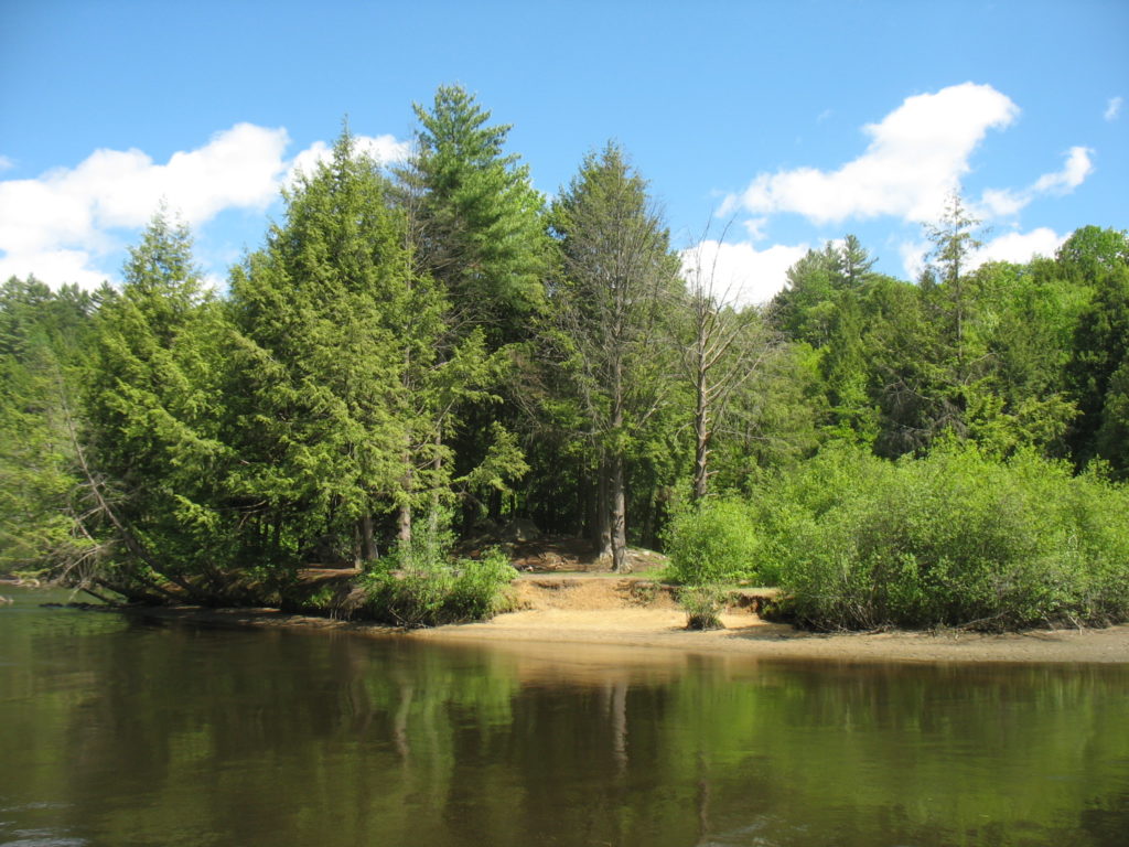
In August, the 2019 Trips Directorate sent out an e-mail to all Trips volunteers that stated that they would no longer be using Gilman Island to train volunteers as it had been discovered that Gilman Island “was previously referred to by a name that included a racial slur.” In the e-mail, the Directorate called upon members of the Dartmouth Community to look into the history of Gilman Island. So, The Review did just that.
In April 1785, Gilman Island was named for Founding Father and New Hampshire delegate, Representative, and Senator Nicholas Gilman. Gilman was born in Exeter, New Hampshire in 1755. Although he was not known for his speeches, Gilman was an integral part of New Hampshire’s eventual acceptance of the Constitution and served as the chairman for the Committee on Revisal and Unfinished Business. In 1789, Gilman voted to pass an act that enforced the Ordinance of 1787—a bill that included the prohibition of slavery in the northwestern United States.
Like most of the Founding Fathers, Gilman was a slave owner. According to Gilman’s estate inventory, his slave’s name was Peter. Gilman lived near Exeter, NH and it is not clear whether he frequented Hanover.
Additionally, it is not clear whether Gilman himself owned the island. The earliest records available of activity occurring on Gilman Island do not involve Gilman; in 1790, Hanover residents Dr. James More and Dr. George Eager sued Mr. Johas Murch for burning the Pest House on Gilman Island. In the late eighteenth century, legal disputes like these were settled by the legal voters of the Hanover in a town meeting; the town voted that Mr. Murch would have to pay damages. Not much is known about the men involved in the case. Dr. Eager was recruited to fight the Revolutionary War under Timothy Bedel’s New Hampshire Militia Regiment and served as a surgeon. Dr. More was a prominent surgeon in Hanover until he left the town in 1795.
The next record of town involvement in the Connecticut River Islands are from 1807: Mills Olcott, a Hanover resident and a member of the Dartmouth College Class of 1790, received rights to build a dam on the river. The Wilder Brothers’ paper company bought the rights from the Olcott family in 1882. In the early 20th century, the area was bought by International Paper.
Founded in Albany, New York on January 31, 1898, International Paper was a paper company that slowly diversified to build up and provide extensive hydroelectric power across the Northeastern United States. In the spring of 1923, the Connecticut River experienced severe flooding that financially harmed International Paper as several logs were flooded out of Vermont and down all the way to Holyoke, Massachusetts. As will be explained later, by the 1920s, there were no people living on Gilman Island—occupants had left in favor of creating a more permanent residential neighborhood on the mainland.
Sometime between Gilman’s death and 1891, Gilman Island became known as Negro Island. In later maps—such as the ones presumably seen by the Trips Directorate—the island was identified as N— Island. In Colleges all around the North East, there were similarly named islands and plots of land. For example, after slavery ended in Maine, black families moved to ungoverned islands that were later renamed “Negro Islands” on maps from Bowdoin College. Gilman Island appears to have been an island similar to this.
In the 19th century, Hanover’s former slaves clustered in two locations: the South Main Street Hill and Gilman Island. These locations were respectively referred to as “N— Hill” and “N— Island” by locals. There are not many records of the individuals who lived in these locations.
One woman’s name was Sophy Jones—she lived on a small cottage near the bottom of the hill leading down to Mink Brook and she mostly kept to herself. Known as “Aunt Sophy,” Jones was an important part of Hanover’s history. Her small cottage had a vibrant garden that attracted many admirers across town.
By the time that Jones died in September 1878, she had spent thirty years in Hanover tending that garden. Her early life was not nearly as happy as her time in Hanover. A devout Christian, Jones was born in east Maryland and to parents who had bought their freedom. Her first husband died, and her children were bought by different slave owners in South Carolina. She later remarried a preacher who was then killed during a slave revolt. A proud and intelligent woman, when Jones was told by one of her employers that Uncle Tom’s Cabin was “overdrawn”, she requested that the book be read to her out loud. At the end of the reading, Jones commented that while she didn’t know Uncle Tom or his cabin, she did “know that every word of that book was true, and most all of it she had suffered herself.”
Throughout every hardship, she found comfort in God. Eventually, Jones was brought up North. In July 1845, Jones was bought by a man known as Mr. B—. Mr. B— gave Jones wages and, with those wages, Jones purchased her small cottage on the hill. Families all around Hanover would seek Jones’s help and the children of the town doted on her homemade root beer and cakes in the summertime. The town pastor would often turn to Jones for an engaging, sophisticated discussion on the “doctrines of the Gospel.” In 1869, Jones was photographed by Henry Osgood Bly—a local Hanover photographer.
Given the time period, it is also possible that Dartmouth President John Wheelock’s slaves—Brister, Archelaus, Lavinia, Anna, and the family’s children—also lived in this area. Additionally, during this time period, more than three dozen black individuals were buried in the town’s cemetery. The people who lived on Gilman Island and on the South Main Street Hill likely had small, stout homes that were clustered together.
There are certain recorded instances of black individuals not living in these areas. In 1819, Dartmouth’s first black graduate, Reverend Edward Mitchell ‘28, moved in to a house with the family of Reverend Francis Brown—Dartmouth’s third president. This was likely due to Mitchell’s employment in the Brown household as a porter. After his first year enrolled in the College, Reverend Mitchell moved in to the house of Mrs. Brown’s niece and her husband Professor William Chamberlain Jr.
Hanover’s N— Island was not the only N— Island in the United States. As localities often named locations “descriptively,” there were several places that had similarly derogatory and offensive names.
As of 2011, the United States Board on Geographic Names listed 757 streams, mountains, cities, and civic buildings that were still officially using variations of “Negro” in their titles. From time to time, individuals have attempted to rename these locations after local and national controversy. One barrier to name changes include the heavy red tape that name-changes require—locals sometimes become discouraged as they must first approach state officials before getting approval from the U.S. Board on Geographic names. The Board wasn’t created until 1890, so many of the names that communities are attempting to change pre-date the establishment of the Board.
U.S. Board on Geographic Names Policy V plays a large role in the national re-naming of different place locations. Policy V—a policy governing derogatory names—prohibits “the inclusion of a word in any official geographic name considered by the Board to be derogatory to any racial, ethnic, gender, or religious group.” In 1963, after a recommendation by Secretary of the Interior Stewart Udall, the U.S. Board on Geographic Names ordered a renaming of all offensive names regardless of local usage. Accordingly, places that included “N—” in its name were required to be changed to “Negro.” Most of the maps of Gilman Island were created before 1963.
In the 1950s and 1960s, communities across the United States attempted to rename the locations and were often unsuccessful because the new names that they chose simply didn’t stick.[36] The names of different locations become ingrained in the locality’s culture. Backlash from locals or a simple lack of adoption hindered these changes.
The change back to Gilman Island originated in a March 11, 1969 Hanover Town Meeting. Mrs. Karen Nice proposed to “change the name of the island located in the Connecticut River from [N—] Island to Gilman Island.” In line with the rules described previously, this local change was insufficient to legally change the name. Hanover’s New Hampshire State Representatives William R. Johnson and Laurence I. Radway put forth HB 648—“An Act Changing the Name of [N—] Island in Hanover to Gilman Island” on June 3, 1969. The bill was bipartisan: Johnson was a Republican and Radway was a staunch Democrat. Both were heavily affiliated with Dartmouth.
Johnson was a member of the Class of 1953. He was a history major who graduated Phi Beta Kappa, played on both the basketball team and the baseball teams, was a member of Beta Theta Pi fraternity and Casque and Gauntlet, and Army ROTC. He was elected to the state legislature in 1962 and to the senate in 1964. Elected for a third time in 1968, Johnson was appointed to the New Hampshire Supreme Court in 1985. From 1959 to 1999, Johnson returned to Hanover and was an Adjunct Professor of Business Law at Tuck.
Radway taught in Dartmouth’s Government Department for 39 years. Forever an activist, Radway only ran for office when he could no longer convince anyone to run. He was the chairman of the New Hampshire Democratic Party for several years. Radway was known for his strong belief in the power of local government and acted as an inspiration to many of his students.
In all of this history, it is necessary to acknowledge and evaluate the role that Dartmouth played in each of these re-namings. While it is true that Dartmouth’s founding brought the slaves to Hanover that later lived on and around Gilman Island, the College did not contribute to the renaming.
Dartmouth did not gain any ownership over the Island until 1950—due to flooding from the Wilder Dam project, several Dartmouth Outing Club cabins on different rivers along the Connecticut River were destroyed. On February 17, 1950, The New England Power Company officially leased two acres of the island. Later, the College grew worried about only having a portion of the island and it being acquired through a third-party lease. Unlike other land deals that the College made during this time period, the lease on Gilman Island was originally set to expire in 1951—the College would have to renew the lease each year afterwards. Originally, The New England Power Company donated wood and a lease on Gilman Island to the College to compensate for these destroyed cabins.
In the Hanover Master Plan from 2003, the town notes that Gilman Island is owned by The Pacific Gas and Electric Company. In more recent history, Dartmouth currently has a long-term lease on the island which is now owned by the TransCanada Power Company. While there are certainly maps made by Dartmouth that include the name N— Island, Dartmouth did not name the island nor did it even have the authority to do so.
The map of the area drawn in 1912 by R.E. Pritchard of Thayer was based on previous research done by the U.S. Geological Survey. William Gavitt, a member of the class of 1955, created a similar map in January 1954—presumably, for a class assignment—that referred to the island in question as N— Island but also noted that only around a third of the island was leased from the New England Power Company. New England Power Company was a conglomerate of different companies that included International Paper. These are some of the only maps available; although Gilman Island is a relatively large island on the Connecticut and appears in maps by shape, it is often unlabeled.
In the early 1950s, the Dartmouth Outing Club built the original Titcomb Cabin in memory of John “Jack” Abbott Titcomb ’32. A member of Ledyard, Captain Titcomb of the U.S. Marine Core Reserve in the Battle of Luzon in the Philippines on March 1, 1945. In 2009, the original Titcomb Cabin burned to the ground. A group of students spent the next two summers rebuilding Titcomb Cabin by hand out of 97 pine and spruce logs.
The latest development on the island is the change made by the Trips directorate this year. It is not yet clear whether First-Year Trips will use Gilman Island in its training in upcoming years. Certainly, though, the history of Gilman Island—like the history of most of Hanover—contains some stories that the College has not yet told.
Be the first to comment on "Trips Flees Gilman: A History of Gilman Island"